...
A number of custom maps have been created over the years to fill the gap between local knowledge and official maps.
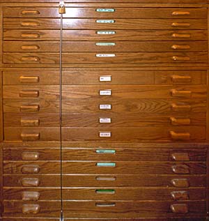
Summary of map cabinet contents
| Drawer | Description |
|---|---|
| 1 | Washington State USGS topographic 15' (1:50,000) |
| 2 | Washington State USGS topographic 7.5' (1:24,000) A-L |
| 3 | Washington State USGS topographic 7.5' (1:24,000) M-Z |
| 4 | Green Trails, Custom Correct, National Parks, National Forest & Wilderness Areas |
| 5Oregon | Washington Miscellaneous maps |
| 6ALASKA: Miscellaneous (a mixed bag, but pretty comprehensive.) | Washington large size maps |
| 7CANADA: Miscellaneous (another mixed bag, but also pretty comprehensive.) | Canadian Maps, mostly west coast provinces |
| 8 | FOREIGN MAPS: Europe (Alps), Mexico, South America (Andes) |
| 9 | FOREIGN MAPS: Asia (Himalaya), Africa, New Zealand, Antarctica |
| 10 | Alaska maps |
| 11California | Idaho and Oregon maps |
| 12 | Western United States other than Washington, Alaska, Oregon or CaliforniaCalifornia maps |
| 13Washington | Environmental AtlasMiscellaneous 1 |
| 14Historical maps | Miscellaneous 2 |
| 15 | Miscellaneous 3 |
Map Indexes for United States Geological Survey (USGS) and Canadian Government Survey Maps are located in a plastic file box on top of the flat map file cabinet. Many foreign map indexes are shown in The World Map Directory 1992-1993, on the reference shelf.
...